Open-source remote sensing tools developed by the Silva lab and collaborators
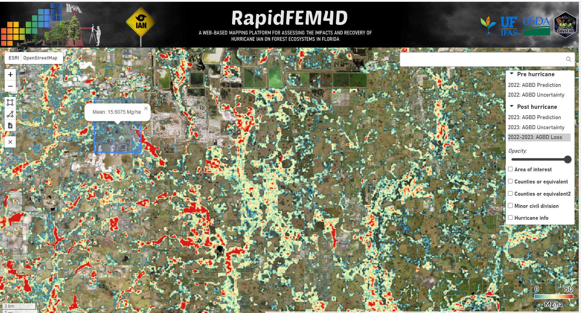
7) RapidFEM4D: An web-based mapping plataform for assessing the impact of Hurrican Ian and recovery of forest ecossystems in Florida.
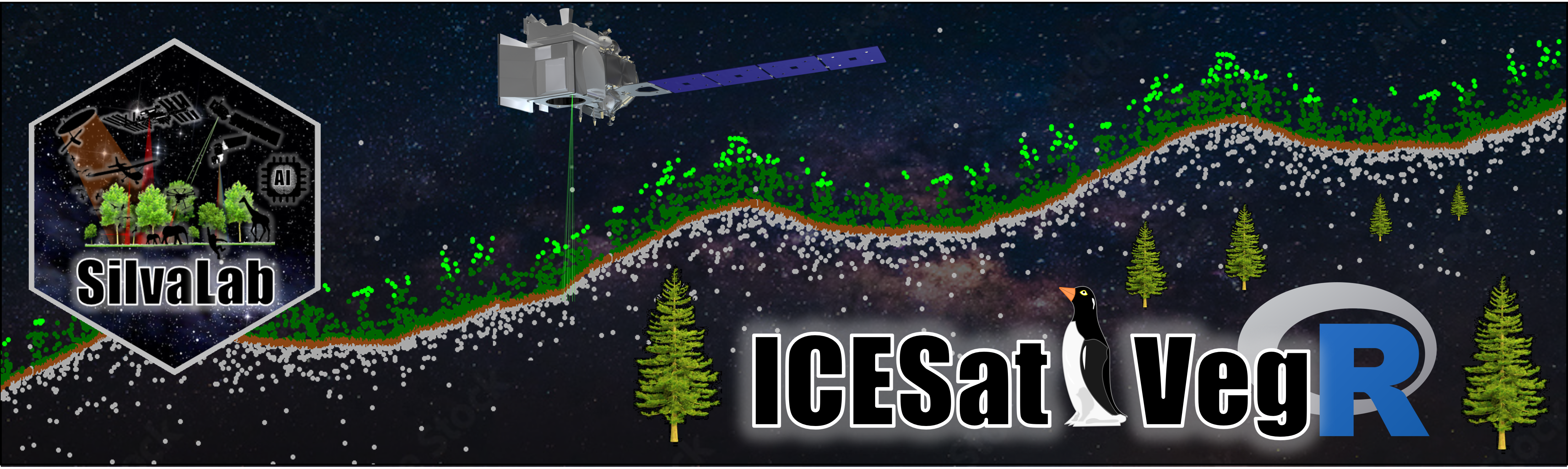
6) ICESat2VegR: ICESat2VegR: An R Package for NASA's Ice, Cloud, and Elevation Satellite (ICESat-2) Data Processing and Visualization for Land and Vegetation Applications.
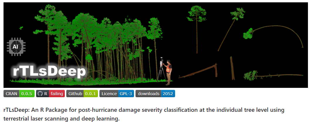
5) rTLsDeep: An R Package for post-hurricane damage severity classification at the individual tree level using terrestrial laser scanning and deep learning.
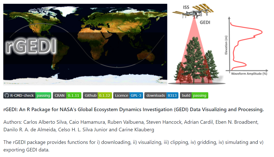
4) rGEDI: An R Package for NASA's Global Ecosystem Dynamics Investigation (GEDI) Data Visualizing and Processing.
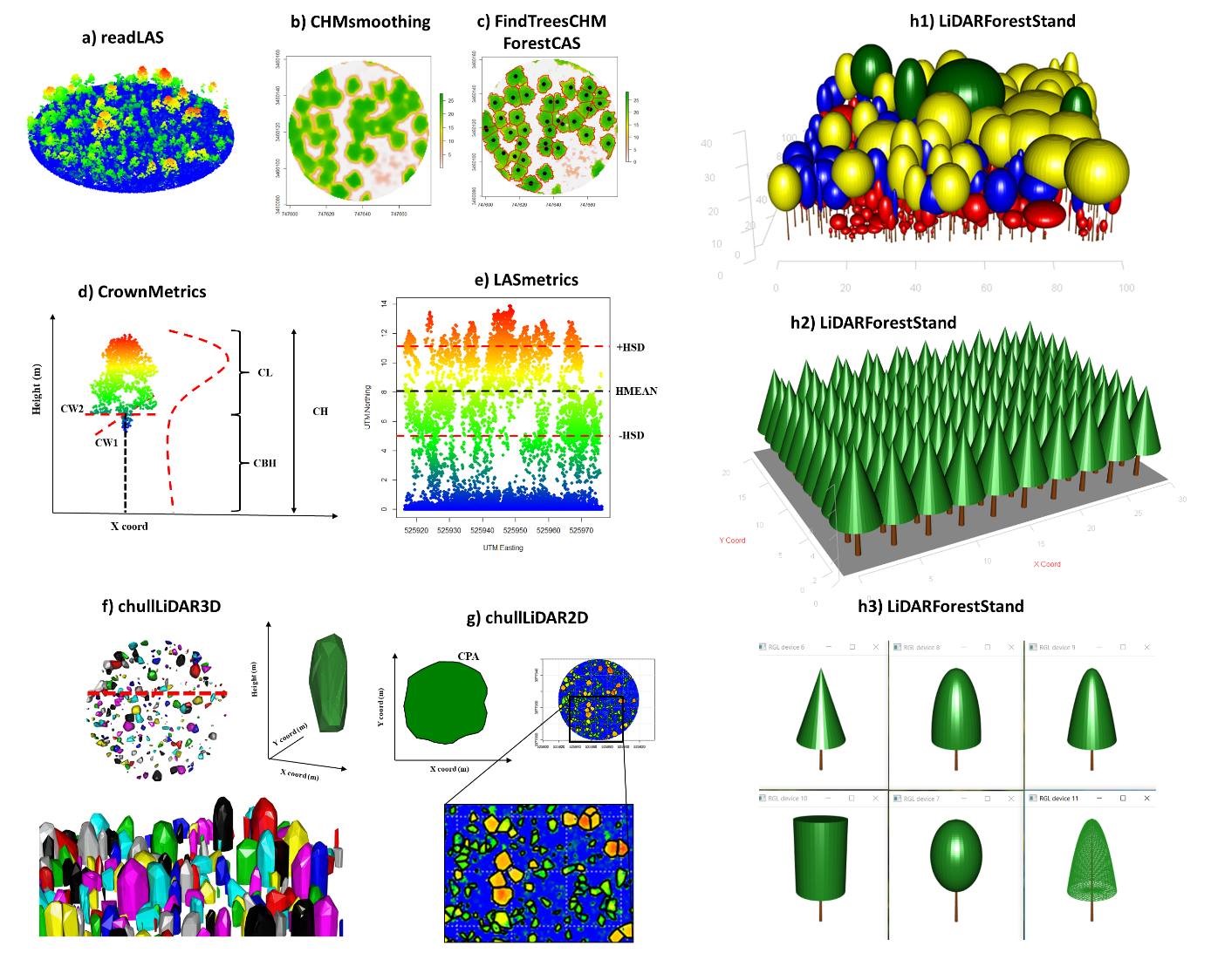
3) rLiDAR: An R Package for LiDAR Data Processing and Visualization.
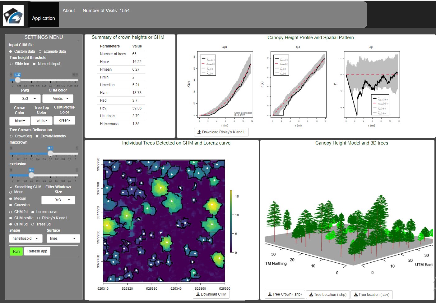
2) Treetop: A Shiny-based Application for Extracting Forest Information from LiDAR data.
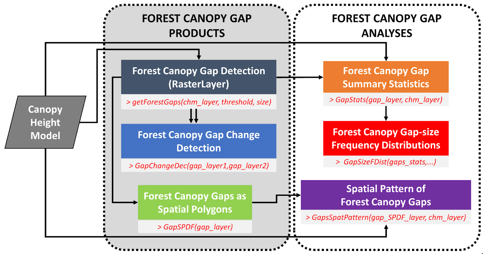
1) ForestGapR: An R Package for Airborne Laser Scanning-derived Tropical Forest Gaps Analysis.